Use of
this site means you accept its terms and conditions.
SHARSMITH PEAK
--Recent naming of another Sierran Peak:
Mt. Andrea Lawrence
Back to Home page
Location information for Sharsmith Peak is copied from the companion website www.name4carl.org.
See below for a map of the Harvey Monroe Hall Research Natural Area (east of Sharsmith Peak)
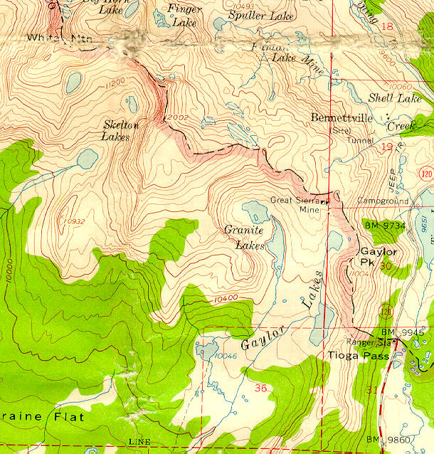
Potion of 15-minute 1956 map "Tuolumne Meadows, Calif." Quadrangle (U.S. Geological Survey) showing location of informally-named Sharsmith Peak:
Informally-named Sharsmith Peak is in the left upper center of the map below, immediately east (to the right) of the words Skelton Lakes, and on the crest of the Sierra Nevada (pink diagonal line with black dashes on its right and running irregularly from northwest to southeast). The number 12,002 appears east of the crest in light brown type, marking the location of informally-named Sharsmith Peak. Along the crest, White Mountain (letters partly rubbed out) is to its northwest and Gaylor Peak is to its southeast. The crest is the boundary between the Yosemite Wilderness of Yosemite National Park on the west and the Harvey Monroe Hall Research Natural Area of Inyo National Forest on the east, as well as the boundary between Tuolumne County on the west and Inyo County on the east.. Tioga Pass--eastern road entrance to Yosemite National Park from Lee Vining--is at the lower right. North is at top.
I
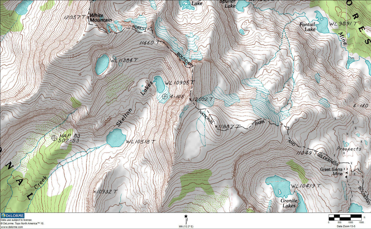
And another USGS topo map from DeLorme Topo, showing Peak 12002 (Sharsmith Peak) just above the map center:
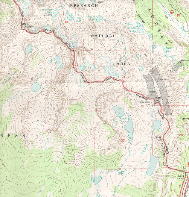
Portion of 7.5-minute 1994 map "Tioga Pass, CA," Quadrangle (U.S. Geological Survey) showing location of informally-named Sharsmith Peak:
Informally-named Sharsmith Peak is in the left upper center of the map below, immediately east of the words Skelton Lakes, and on the crest of the Sierra Nevada (solid red diagonal line running irregularly from northwest to southeast) The peak is near the center of section 23 (just southwest of the red 2 in 23). Along the crest, White Mountain is to its northwest and Gaylor Peak is to its southeast. The crest is the boundary between the Yosemite Wilderness of Yosemite National Park on the west and the Harvey Monroe Hall Research Natural Area of Inyo National Forest on the east, as well as the boundary between Tuolumne County on the west and Inyo County on the east. Tioga Pass--eastern road entrance to Yosemite National Park from Lee Vining--is at the lower right. On this map, the peak's elevation is not shown, but from contours can be interpreted as just over 12,000 feet altitude.
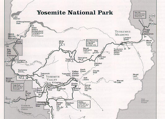
Map of Yosemite National Park showing general location of informally-named Sharsmith Peak at Yosemite National Park/Inyo National Forest border:
The peak is along the park/forest boundary north of Tioga Pass Entrance on the east (right side of map.) North is at top, not to scale.
MAP OF HARVEY MONROE HALL RESEARCH NATURAL AREA (east of Sharsmith Peak)
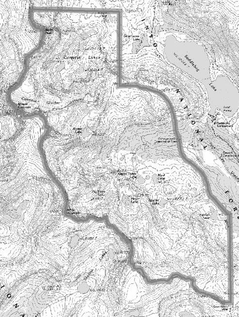 map copied from
http://www.fs.fed.us/psw/programs/rna/gtr_chapters_pdf/harvey_monroe_hall_rna.pdf
map copied from
http://www.fs.fed.us/psw/programs/rna/gtr_chapters_pdf/harvey_monroe_hall_rna.pdf
Send emails to Sharsmith Peak Committtee